The amphitheatre and (Roman) history of Martigny

During the reign of Emperor Claudius (41-54 AD), Martigny, a small village of the Celtic tribe of the Veragres, was turned into a Roman city.

When he became emperor, the emperor undertook the conquest of Britain. He made accessible the most direct route to Britain: the Great St Bernard Pass. At the same time, he reorganised the Valais. The capital was a newly founded city at the foot of the pass. He named it Forum Claudii Augusti, which later became Forum Claudii Valensium, today’s Martigny. It was also one of the two residences of the governor of the Roman province of Alpes Graiae.

The city was built based on the Roman grid system, formed by three series of five insulae, districts for poor inhabitants. These residential blocks were separated by wide avenues.

In the centre were the forum, the temple, the basilica, the public baths and other public buildings.

The amphitheatre was built in the early 2nd century near the quarry for its construction.

The amphitheatre was used until the end of the 4th century. It could accommodate 5000 spectators. The walls have been restored to their former glory.

(Source and further information: www.martigny.ch; F. Wiblé, Martigny-la-Romaine, Fondation Pierre Gianadda, Martigny 2008; F. Wiblé e.a., Vallis Poenina, Sitten, 1998; Fondation Pierre Gianadda)

See also: the Fondation Barry and the Médiathèque Valais

Collection: Fondation Pierre Gianadda. Photo: TES

Reconstruction of the Forum and Roman city. Collection: Fondation Pierre Gianadda.

The ancient Via Rome-London

The Mithraeum temple  

The Domus Minerva

The location of the Roman thermes 

Martigny, copie of a masque from the Roman theatre  of romain de Vaison-la-Romaine (France)

The Tepidarium

One of the Insulas

Impression of the amphitheatre

Impressions of Martigny

The old town

The Bâtiaz bridge (Le pont de Bâtiaz) 

Bâtiaz Castle (Château de la Bâtiaz)

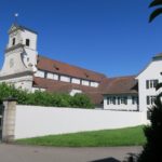
The church Saint-Michel


Napoleon and his generals stayed in these houses upon their crossing of the Grand-Saint-Bernard.

Napoleon on the Grand-Saint-Bernard

The main square in the city centre

The town hall

The church Notre-Dame de la Visitation

The moulin (mill) Semblanet and the museum

The Manoir de la ville

Beinwil, Passwang, Mills, Iron, Hohe Winde and Kamms

The former monastery of Beinwil and the Benedictine monastery of Mariastein (canton of Solothurn) are as inseparably linked to each other as the river Lüssel is to the Jura mountain range of Passwang with Vogelberg (1204 m) in canton Basel-Landschaft as its highest point.

View from the top of the Vogelberg.

The source of the Lüssel is near the Vogelberg in the municipality of Lauwil at an altitude of 1080 metres. It flows through the Bogental (Canton of Basel-Landschaft), the Chessiloch and the valley of Beinwil (Canton of Solothurn), past the ruins of Neu-Thierstein Castle (11th century, Canton of Basel-Landschaft) and flows into the Birs at Zwingen (Canton of Basel-Landschaft).

The Benedictine monastery of Beinwil was founded in the 11th century. Beinwil owned a lot of land. For this reason, the municipality of Beinwil is still one of the largest in the canton. There exists even an Unterbeinwil and an Oberbeinwil in this commune of a few hundred inhabitants! The Lüssel flows past the former monastery, and an old mill, ‘the Säge’ (sawmill), a smithy (Hammerschniede) and brickworks (Ziegelhütte) stood along the river.

Die Schmitte or Hammerschmiede in Joggehus

Another mill in the hamlet of Joggenhut (canton Solothurn), the forge ‘die Schmitte or Hammerschmiede‘, stands along the Lüssel. It has been known since 1693 and is still functioning. The forge shod the horses of the tenants of the monastery’s farms. After all, iron was plentiful in the area.

Bergrestaurant Erzberg

The village of Erschwil along the Lüssel and the Ertzwil Inn (Bergrestaurant Erzberg) are reminders of this past. The forge was bought in 1868 and has since been continued by George Anki. The company George Anki AG in Erschwil still exists today. The two wheels of the forge still function. The large wheel drives a hammer and a grinding stone, and the small wheel operates a bellows.

Restaurant-Gasthaus Zum Reh in Joggehus in 2024, the beginning of the 20th and 19th centuries. 

The abbot of Beinwil also founded an inn at Joggenhut in 1708 to accommodate the many pilgrims.

Nature is also of great beauty. For this reason, the SAC has even named a path, the SAC anniversary trail, to the Hohe Winde (1206 m), the highest peak in the area. Another path leads to the Kleine Winde.

The Lüssel  near Joggenhut at the beginning of the Hohe Winde path of the SAC (Jubiläumsweg Hohe Winde)

The trail

The Lüssel  near Erschwil

The mountains, hiking trails, forests, meadows, streams and (Alpine) views of the jubilee trail give an impression of the varied and impressive Jura and alpine landscape.

The summit of the Hohe Winde offers views of Passwang, the Schwarzbubenland, the Jura, the Alps, the Lüssel Valley and the cantons of Jura, Solothurn, Bern and Basel-Landschaft.

The summit of the Hohe Winde

The 20-kilometre Passwangstrasse (Passwang Road) runs along the Lüssel. This road and the Passwang Pass (943 m) connect Laufen (Canton of Basel-Landschaft) and the Balsthal (Canton of Solothurn). The Pass has also always had strategic and military significance.

The 200-metre Passwang Tunnel (from 1933) gives an impression of the mighty natural fortress, where from 1939 and during the Cold War (motorised) divisions, tanks and a border brigade were stationed. Its headquarters were in nearby Mümliswil.

Mümliswil and the Haarundkamm Museum

Mümliswil (Solothurn canton) in the Guldental valley is not just any village. British royalty, German emperors and half of Europe used combs ‘made in Mümliswil’!

The even smaller village of Ramiswil is home to one of the country’s best-preserved mills (Mühle Ramiswil), built in 1596. Another place of interest is the Heilig-Blut-Kapelle and its remarkable genesis, which stretches from Schellenberg (Liechtenstein) to Dayton (Ohio) in America!

Ramiswil

The Heilig-Blut-Kapelle

Mühle Ramiswil

The Gulden Valley (Guldental) and its stream

The Swiss Alpine Club

The Swiss Alpine Club (Schweizer Alpen Club, SAC/Club Alpin Suisse, CAS) regularly organises hikes in this area and elsewhere in the country.

(Further information: www.sac-cas.ch)

Impressions of the Landscape

Mariastein Abbey

A Maria chapel, “im Stein” (in stone), was first documented in 1434. However, there was already another chapel, a rock chapel. The Chapel of Grace (Gnadenkapelle) is still visited by around 250,000 pilgrims annually.

It is the heart and destination of the Mariastein pilgrimage. Over the centuries, the rocky cave has been converted into a chapel, which is reached by a staircase with 159 steps carved into the rock.

The Chapel of Grace

The legend

It is known (according to legend) why there is a chapel of the Virgin Mary: in 1442, a boy fell into the valley at this point and miraculously remained unharmed by the intercession of the Mother of God.

From this event, a richly embellished legend developed. Soon, the place of pilgrimage attracted believers from near and far. The priest of Metzerlen had to be supported by a pilgrim’s priest. Around 250,000 pilgrims visit the chapel annually!

The Chapel of Sorrows is a pilgrimage chapel built at the end of the 15th century on the edge of the rock above the ground. Today, the chapel is integrated into the monastery’s complex.

The Reichenstein family adorned the chapel with its coat of arms. On the opposite wall is the large votive image of the municipalities of the area called “Leimental”, which reminds us that these communities put themselves under the protection of Mary in the rock “Im Stein”). The swords are emblematic representations which point to the seven sorrows of Mary.

The miraculous image

On the wall of the windows hangs the so-called miraculous image (Das Mirakelbild), which reminds us of the salvage of the Junker Hans Thüring Reich of Reichenstein, In a scenic process (fall, discovery, rescue, cure in the Mill of Flüh (Flühmühle) and return to the Landskron castle, the whole story is shown.

The miraculous image (1543) in the Chapel of Sorrows

The mill, Flühmühle, 1543

The Flühmühle in 2022. Photo: Marijke Brink

History

In the middle of the 17th century, the Benedictine monks from Beinwil (canton Solothurn) moved their monastery to Mariastein.

The monastery and church of Mariastein in Metzerlen (Solothurn Canton) were built between 1636 and 1655. The church of the new Benedictine monastery was consecrated on 31 October 1655.

At first, the late Gothic style found its way. However, between 1830 and 1834, the façade and the church tower were erected in the classicist style. The church was decorated and painted neo-baroque between 1900 and 1934. Ludwig Stocker (1932) designed the cloister square in 1997.

On 5 July 1926, Pope Pius XI (1857-1939) raised the monastery church to the status of Basilica Minor.

The monastery, around 1680. Information Centre Mariastein

The monastery complex

The interior

The monastery has an eventful history. In March 1798, the French general Balthasar von Schauenberg (1748-1831) entered Mariastein, destroyed the monastery and sold its possessions. The ruined abbey was repurchased in 1802 by Abbot Hieronymus Brunner (1739-1804).

However, the Solothurn canton and the federal government wanted to keep and bring economic life under strict control and a special tax impoverished the monastery. Two monks stayed, and religious life and pilgrimage continued in the Catholic canton.

The rest of the monastery moved to Delle (France) but had to leave France in 1901. The monks moved the monastery to Bregenz (Austria). In 1941, the Gestapo forced the Benedictines to leave their monastery.

Information Centre Mariastein

The Canton of Solothurn permitted the monks to return to the monastery. On 21 June 1971, the canton finally handed over a document sealing the abbey’s return to the Benedictine Order.

(Source: www.kloster-mariastein.ch).

The St. Anna-Chapelle 

The Klosterhotel Kreuz 

Brochures in more than 30 languages, including Romansh